3D MODELING, VISUALIZATION & VIRTUAL REALITY
Virtually There...
Needless to say, reality is complex...really complex. Fortunately, 3D Models offer a simplified and focused environment for users to effectively experience, analyze, and communicate geographic information within virtual context. Advancements in capturing and generating 3D content keeps pushing the limits of GIS (Geographic Information Systems), creating new and innovative opportunities including physical 3D Prints. While most 3D modeling applications have a very focused project role, an effectively formulated 3D database can also take on a broader and more inclusive function within an existing GIS environment, strenghting established databases, systems and laying the groundwork for future expansion.
Communication+
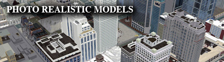
Enhanced visualization is a key application of 3D modeling. Users better associate with 3D environments because they are closer to an actual on-site experience. Interacting with complex environments where heights above ground or even below ground come into play, such as pipeline networks, viewsheds, or drainage patterns, are improved when provided with a 3D environment for better context. Ultimately, this can lead to utility field technicians improving documentation of issues or a planning department more effectively illustrating to a public review commission how a new wind farm project will impact a landscape.
'What If' Factor...
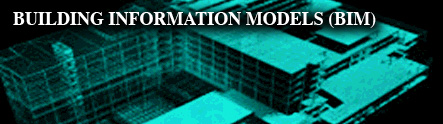
Simulation is another powerful tool in the 3D arsenal. Whether it means widening a state highway or re-envisioning an abandoned waterfront, users can experiment with geographic ideas and events, testing situations without impacting actual environments or individuals. 3D simulation helps uncover the potential impact of actions and events - improving understanding, avoiding issues, and improving decision-making.
Big Picture
Effective geographic information systems are structured with the bigger picture in mind; laying a foundation for future expansion and integration. 3D datasets should be approached similarly. While a 3D project may have a specific intention, this doesn't mean that it can't also serve other needs within an existing GIS (Geographic Information System) environment. So, considering how new 3D information can be adapted and integrated into established systems is always an important and cost-effective opportunity that should not be overlooked.
Foundations
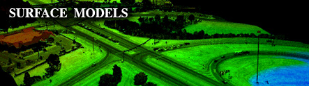
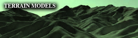
There are quite a few options for modeling 3D environments - photogrammetry, laser surfacing, CAD construction, or even animated simulations similar to gaming environments. User specifications obviously drive how modeling projects are initially approached, depending on the degree of detail and type of information needed. Every technique has its own advantage relative to the application, which can even support 3D Printing.
Questions
3D Geographic Information is a powerful resource for approaching geospatial challenges differently or expanding the capability of an existing GIS (Geographic Information System) Solution - improving visualization, analysis, communication, and decision-making capability. Feel free to get in touch with us for more information on how to take advantage of 3D GIS and how Access Geographic can help.